01 / 08
Kitewall in flight

Tethered · Autonomous · Persistent

Kitewall
ISR System

Persistent airborne intelligence, surveillance & reconnaissance — powered by wind. Sensor agnostic platform with modular payload capacity.

500 m
Altitude
80 km
Line-of-Sight
24/7
Continuous
20 kg
Payload
Scroll

System Overview

Tethered Wind-Powered
ISR Platform

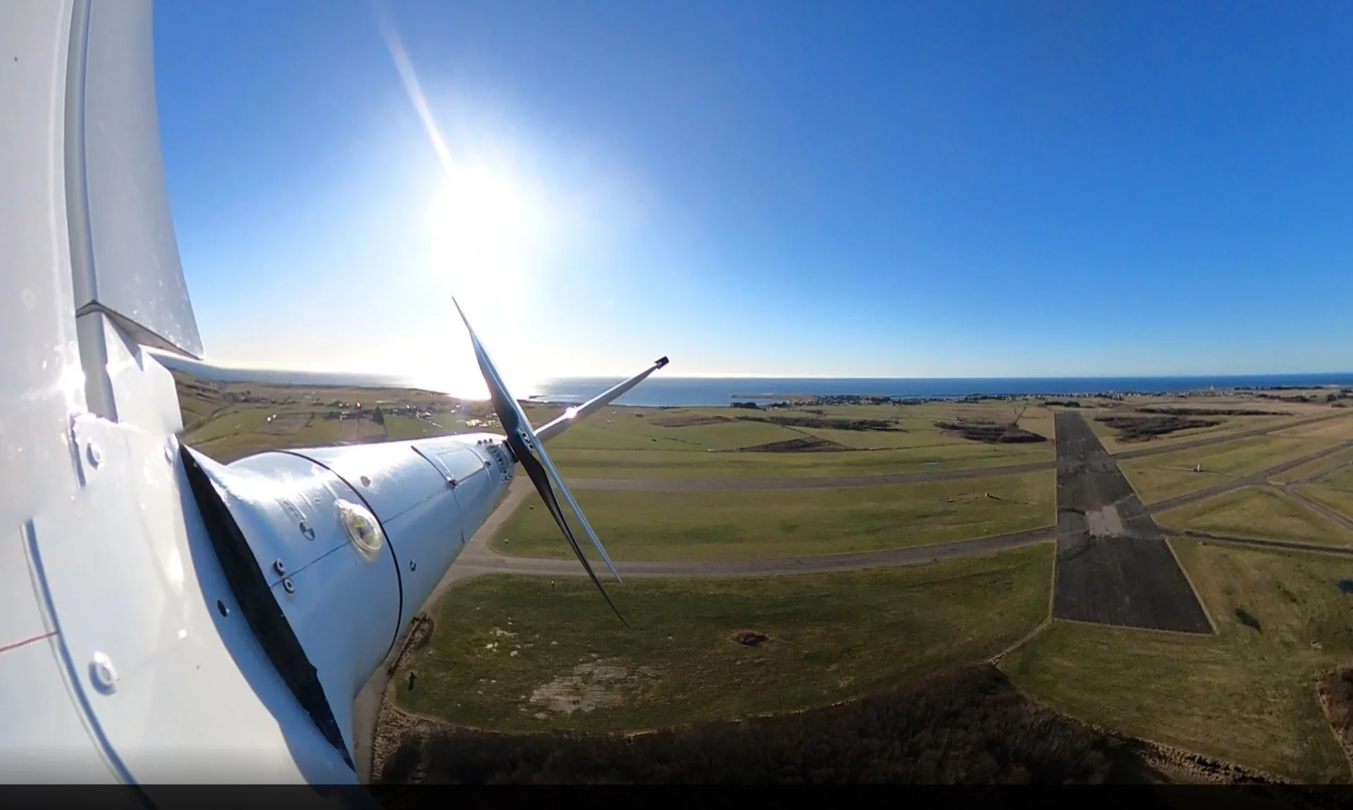
The Kitewall platform is sensor agnostic with a modular 20 kg payload capacity supporting a wide range of EO/IR, radar, and communications equipment.

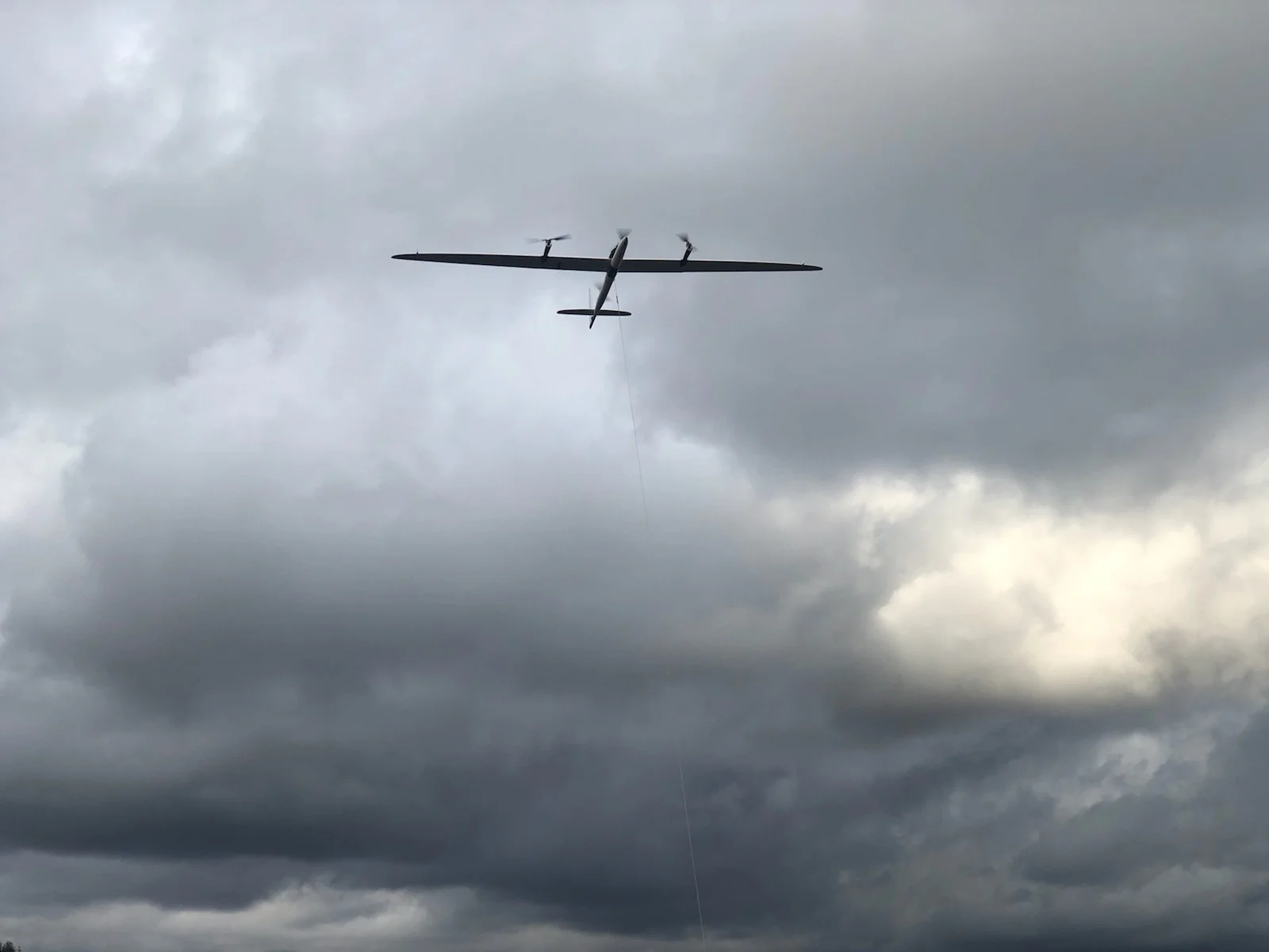
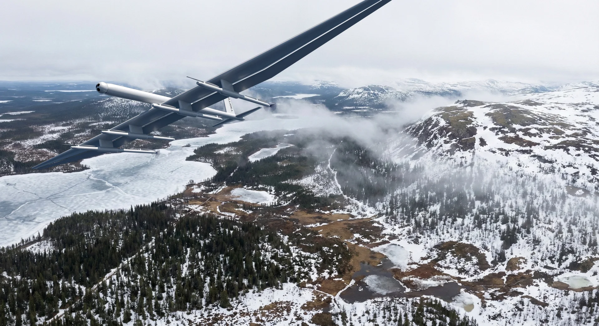
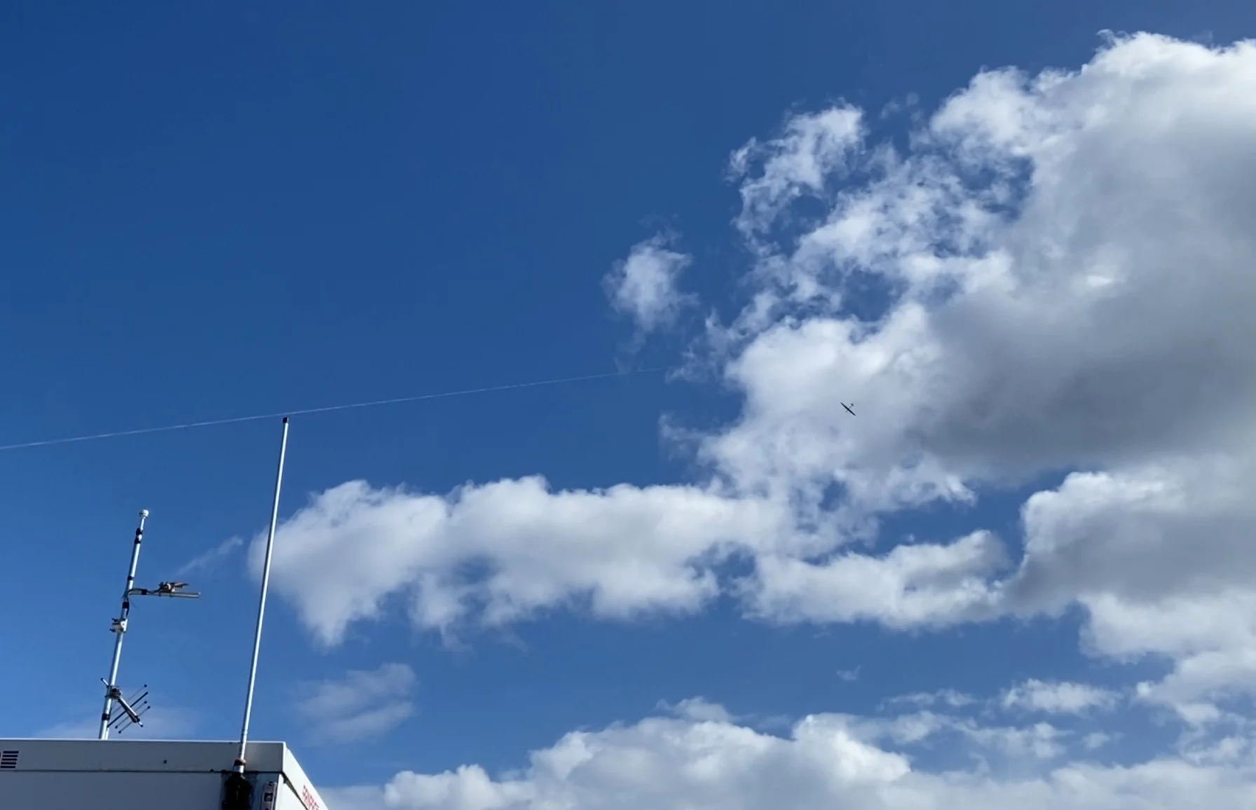
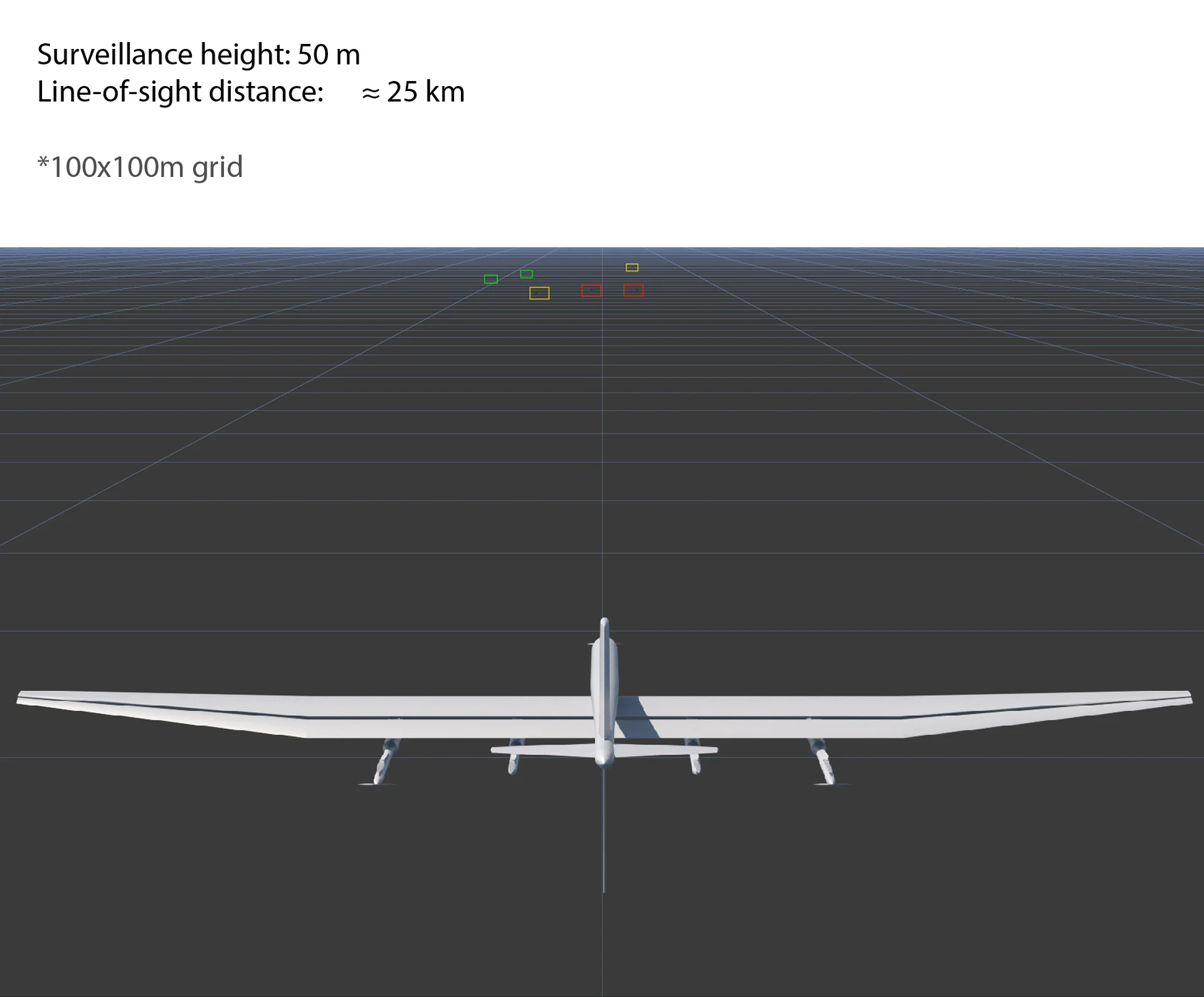
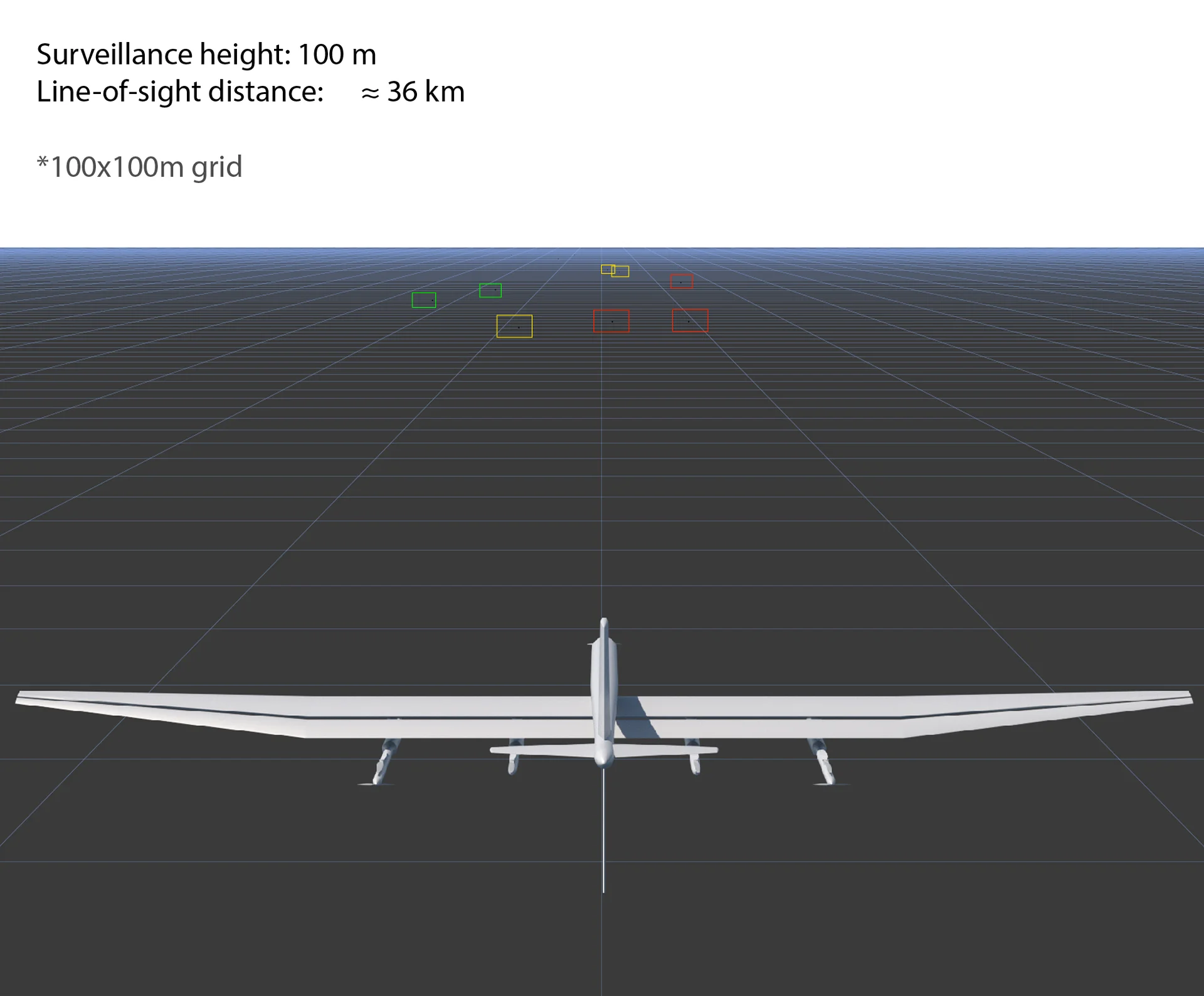
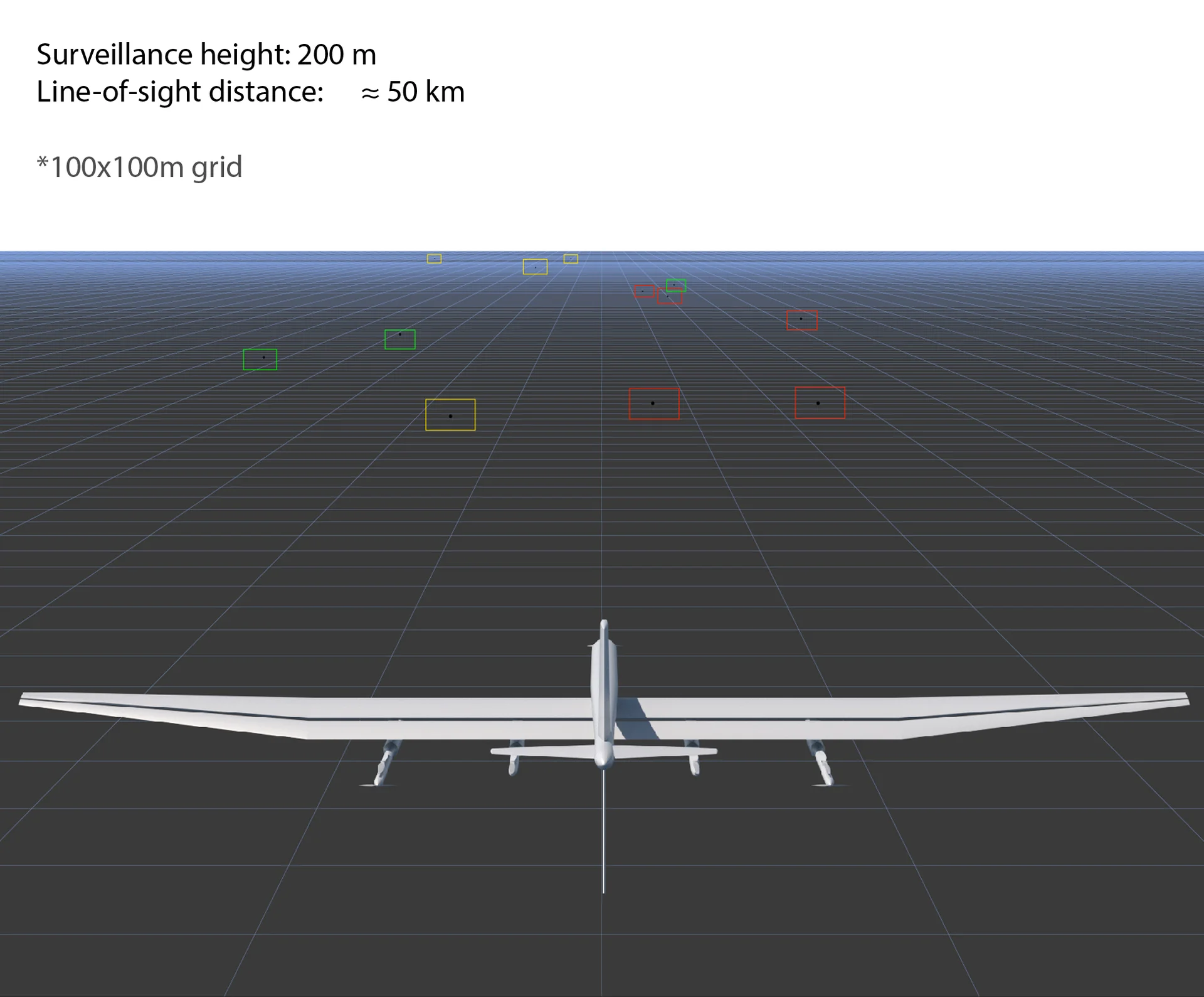
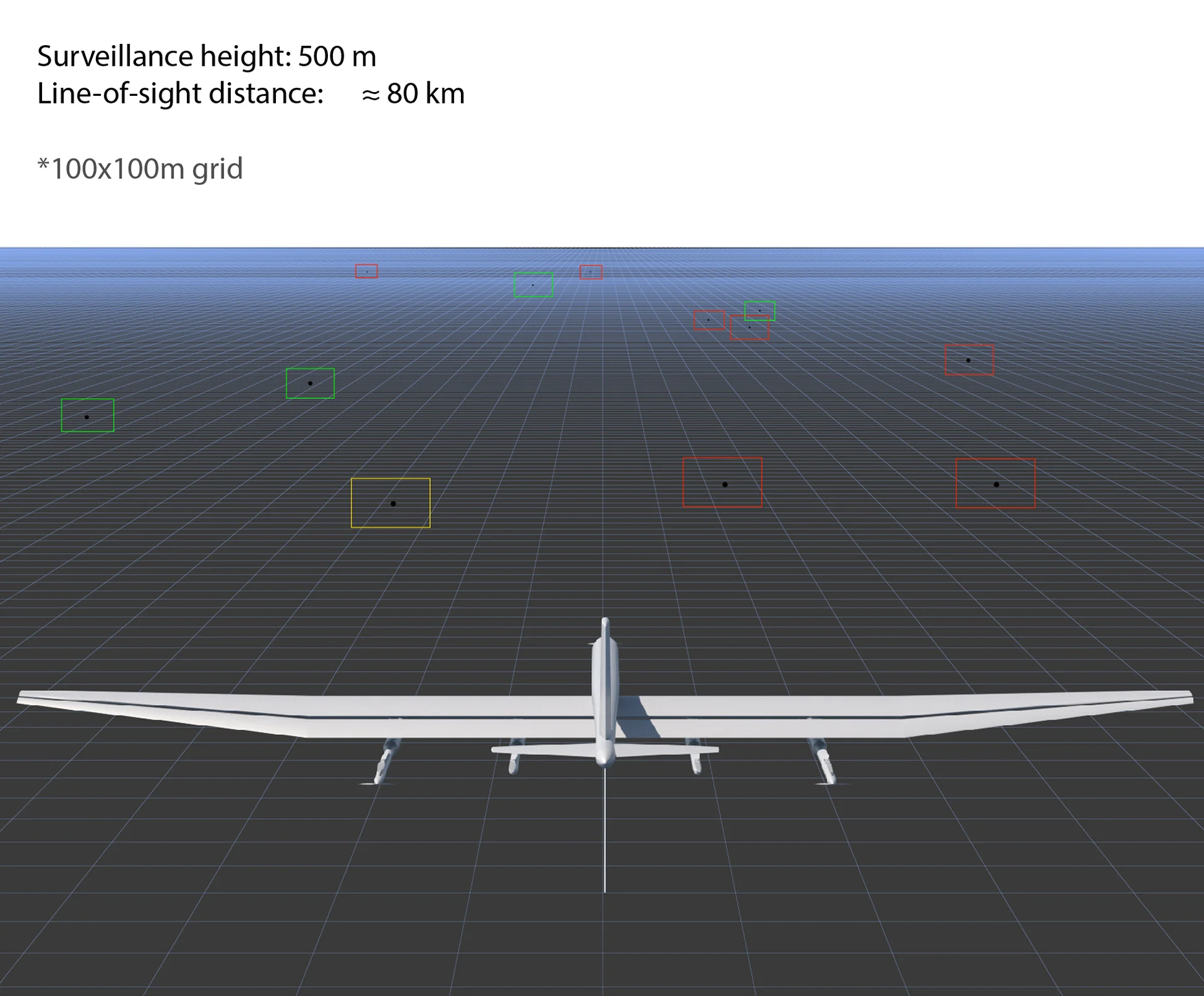
The system uses a tethered kite at altitudes up to 500 m, harnessing wind energy for unlimited flight endurance. The platform is net energy positive for both ground station and airborne platform.

Ground Station
Laptop-based mission control. Daylight-readable display.
Data Terminal
50 km RLOS range. AES-256 encrypted link.
Tether System
High-strength composite. Power and data transmission.
Power System
15 kW wind generation. Grid or off-grid.
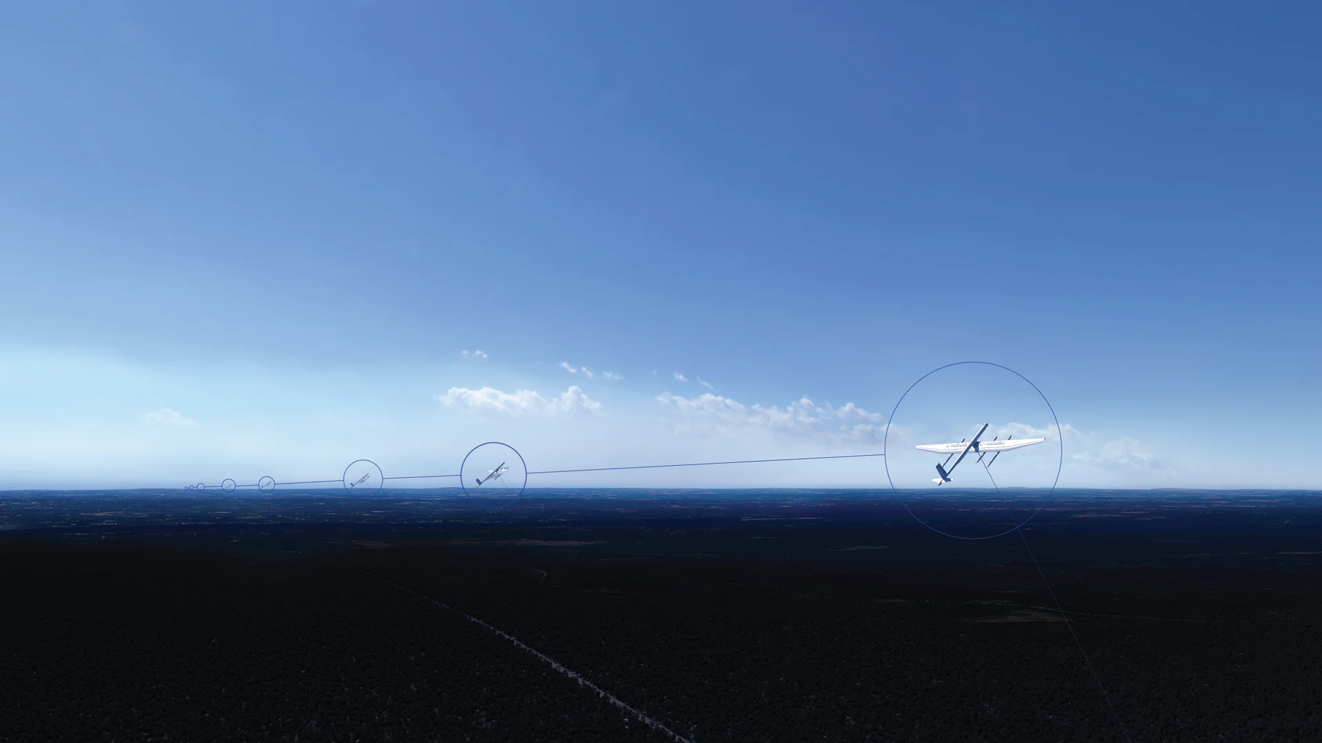
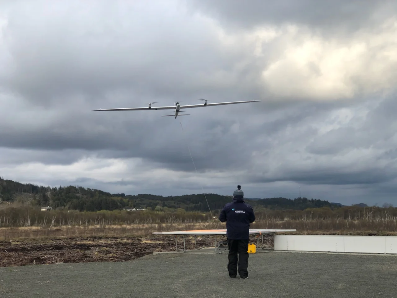
Detached Patrol Mode
The kite can disconnect from the tether to fly patrol missions. Fully charged batteries at 500 m provide unmatched response time. Untethered flight enables centralized inspection and maintenance.
Tethered mode
Tethered Mode — Persistent Surveillance
Detached patrol
Detached Mode — Extended Patrol Range

Technical Data

Specification

Platform
TypeTethered kite
Operating altitudeUp to 500 m
Line-of-sight80 km
Surveillance radius~50 km
EnduranceUnlimited*
Power generation15 kW
Payload capacity20 kg
Launch / recoveryVTOL
OperationFully autonomous
Flights completed900+

*Scheduled inspection and service required

ISR Payload
Gimbal2-axis stabilized
EO sensorFull HD TV
EO resolution1920 × 1080
Optical zoom30X
Digital zoom3X
HFOV (EO)63.7° – 2.3°
IR sensorLWIR thermal
IR resolution640 × 512
HFOV (IR)18°
High perf. INSYes
Geo-referencingYes
Communication
Frequency2.2 – 5.1 GHz
Alt. frequency4.4 – 4.9 GHz
EncryptionAES-256
Range (RLOS)Up to 50 km
Network typeMIMO / MANET / MESH
Anti-jammingYes
Optional CRPA GPSYes
Comm relay modeYes
ADS-B transponderOptional Mode-S
Video & Data
Resolution1920/1080p
Frame rate30 fps
EncodingH.264 / H.265
MetadataSTANAG 4609 KLV
On-board recordingYes
Target trackingMoving & stationary
Geo pointingYes
Picture-in-PictureEO + IR overlay
Environmental
Temperature−20° to +50°C
Precipitation10 mm/h
Wind (operation)0 – >25 m/s
Wind (survival)>25 m/s
DRI (EO — human)
Detection14 km
Recognition6 km
Identification2.5 km
DRI (IR — vehicle)
Detection3,850 m
Recognition950 m
Identification295 m
Kitewall at operational altitude

Surveillance & Altitude

Altitude
Advantage

Autonomous Detection
AI-powered object detection identifies vehicles, personnel, and vessels in real time. Geo-referenced coordinates transmitted automatically.
Persistent Coverage
Wind-powered flight enables continuous operation without battery or fuel logistics. No coverage gaps.
Altitude = Coverage
Higher altitude provides wider surveillance area. The images below show a 100 × 100 m reference grid from four operating altitudes.
50m POV
50 m
Close Surveillance
100m POV
100 m
Tactical Overwatch
200m POV
200 m
Area Surveillance
500m POV
500 m
Wide Area ISR
Daytime operations
Daytime Operations
Full HD TV camera provides high-resolution imagery for target identification, surveillance, and monitoring. Onboard camera perspective from Lista airfield, Norway.
Night operations
Night Operations
LWIR thermal imaging detects heat signatures in complete darkness. Near-infrared mode for low-light visible imaging. Automatic target tracking.
24/7
Continuous Operation
900+
Flights Completed
360°
Gimbal Rotation
0 crew
Airborne Personnel
Deployment

Operational Deployment

All-Weather
Arctic Capable

Proven in Nordic conditions. Container-based deployment with minimal ground crew. −20°C to +50°C, rain up to 10 mm/h, wind 0 to >25 m/s.

Coverage Planning

Scalable Wall Formation

Multiple kites deployed in formation for wide-area surveillance with overlapping coverage zones. Each unit operates autonomously.

Wall Configuration
Line formation for wide-area border surveillance with overlapping coverage zones.
Spacing: 300 m
Sensor fidelity through distributed triangulation. Claims airspace sovereignty.
Net Positive Energy
Each unit produces net positive energy. Dual use — ISR and energy — lets energy finance operations.
Scalable
Deploy 1 to 50+ units. Each unit autonomous. Sensor fusion across the wall.

Use Cases

Mission Applications

Persistent ISR for defense, security, and critical infrastructure.

Border & Coastal Security
24/7 surveillance of land borders and coastal zones. Detect intrusions, smuggling, and unauthorised crossings.
  • Passive or active sensors
  • Day/night thermal detection
  • Auto vessel tracking
Defense & Military ISR
Persistent battlefield surveillance and target acquisition. STANAG-compliant C2 integration.
  • AES-256 encrypted datalink
  • Anti-jamming MANET/MESH
  • Communications relay
Infrastructure Protection
Continuous monitoring of pipelines, power lines, airports, power plants, ports, and offshore platforms.
  • One operator monitors multiple sites
  • Combined ISR + energy
  • Off-grid capable
Counter-UAS & Early Warning
High-altitude vantage for early drone detection and airspace monitoring.
  • Distributed sensor triangulation
  • Acoustic integration
  • Real-time alert system
Emergency & Disaster Response
Rapid deployment for natural disasters, search and rescue, and emergency comms relay.
  • Container-based deployment
  • Self-powered operation
  • Wide area thermal search
Environmental Monitoring
Long-duration surveys, methane detection, wildfire, and pollution monitoring.
  • Multi-spectral sensors
  • Continuous coverage
  • Zero-emission platform
Persistent Airborne Intelligence